Los Altos Hills - Some Early Reconnaissance Images  

This web page has six images of the area around (what is today known as) Los Altos Hills.

We can't be sure of the exact date they were taken, but we can be pretty sure it was some time between 1945 and 1955 - in fact most likely 1947. (After 1945 because not much of this photography was being done in the U.S. during the war, and before 1955 because there are no signs of the Town Hall being built yet).

There are a total of six images - each chosen to show a certain part of town within its context. But a word of caution - the images are not all displayed at the same scale. Instead, each has been sized to fit an arbitrary screen-size of 1200 by 900 pixels. (If you try to view this web site using a smart phone or other small screen - you are wasting your time)

To help orient viewers to what they are looking at, each of the images has been annotated with a few colored dots - identifying certain landmarks within the town. These dots are described immediately below each picture. (It is assumed that the viewer is familiar with the geography of the town.)


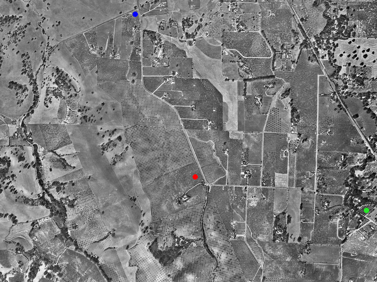
1)   Just to get used to looking at these images and finding your way arond - this is a fairly broad view with the location of today's Town Hall marked with a red dot near the center of the picture.

As is the usual convention, North is towards to top of the picture. So we can see Fremont Road coming in from the North where it starts at the intersection with Arastradero (see the blue dot near the top, and a little to the left of the center of the top edge of the picture)

Near Town Hall, the road has a kink and proceeds due East to the "S" bend and then passes along the edge of (what is today) Edith Park - marked with a green dot.

The diagonal line that appears to be chopping off the top right corner of the picture is the railway line running from downtown Los Altos towards Arastradero. This railway line became today's Foothill Expressway.


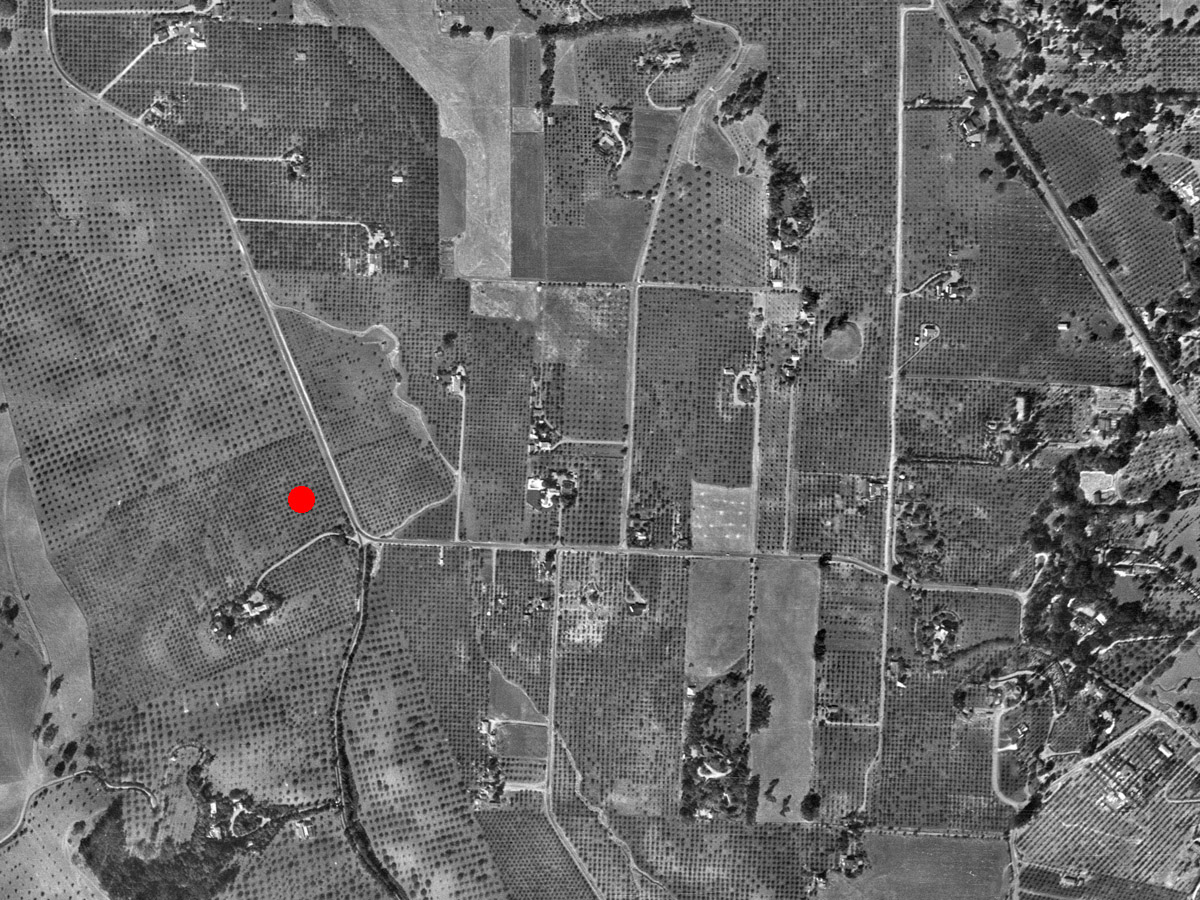
2)   This is essentialy the same location but zoomed in closer so you can see more detail. The red dot is where today's Town Hall is located.


3)  
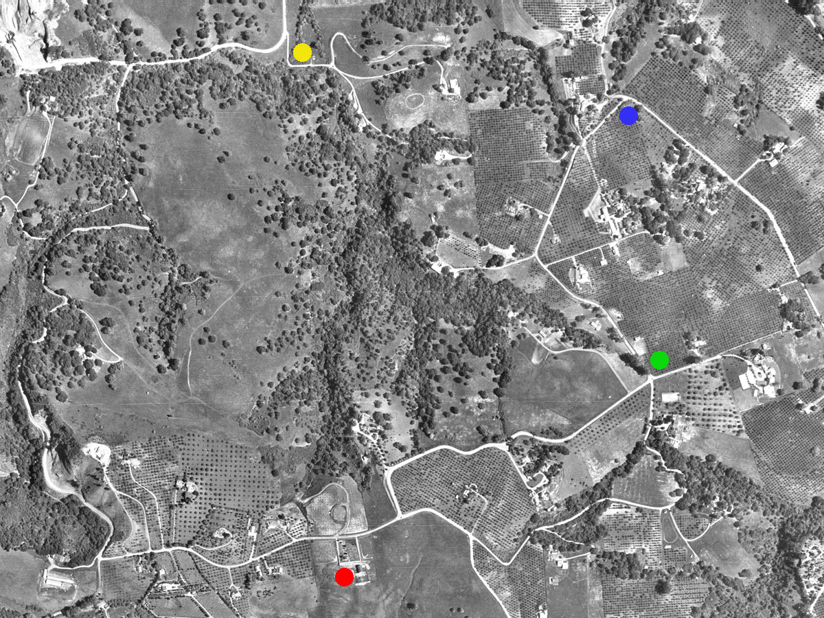
  • Red Dot (at bottom of image) is Westwind Barn, next to Byrne Preserve. Just opposite Byrne Preserve we see the junction where Black Mountain Road originates at its intersection with Altamont Road and heads up and to the right towards......
  • Green Dot is where Black Mountain meets Natoma
  • Blue Dot is where Natoma meets Elena
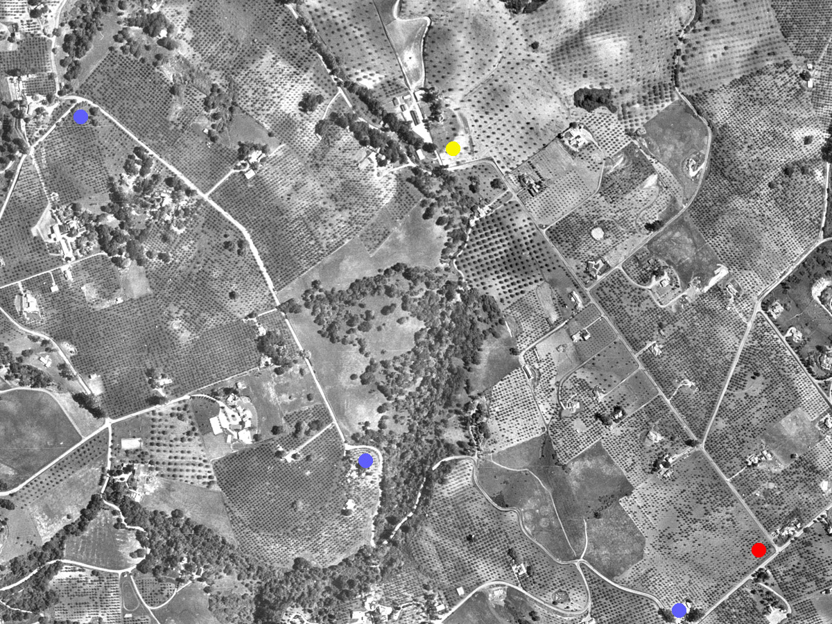
  • Yellow Dot (at top of image) is where Page Mill is curving round just where Three Forks is located. You can then follow Page Mill Road "up hill" down the left side of the image as it passes where Alexis Drive exits, and then up past the two hairpin bends at Matadero Creek Lane and Via Ventana, then continuing on up to the intersection with Altamont which leads to Westwind Barn.


4)  
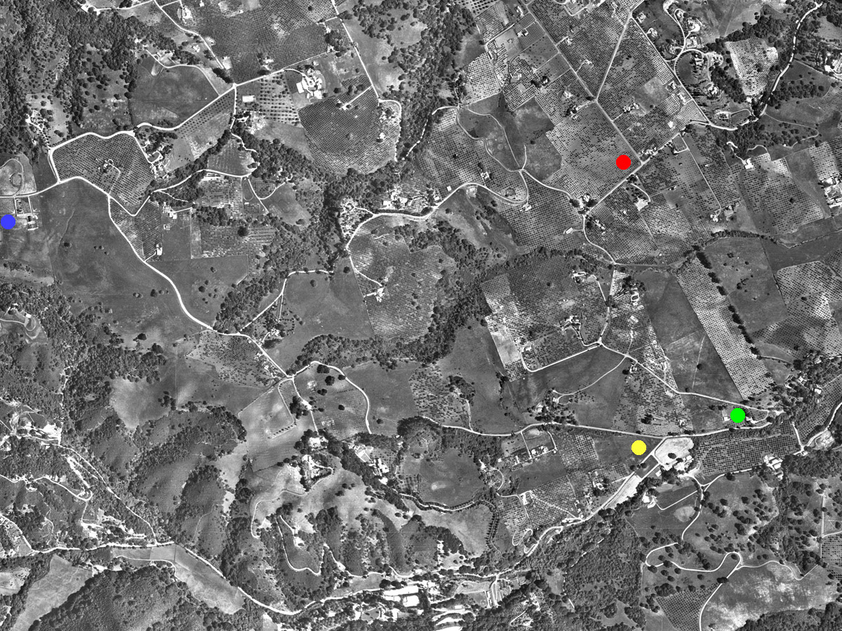
  • Blue Dot (left edge of image) is Westwind Barn on Altamont Road - whish leads downward and to the right to
  • Yellow Dot at intersection of Altamont and Moody Rd which is comming across the bottom of the image.
  • Green Dot at intersection of Moody Road and the end of Elena - close to the Fire Station at Foothill College
  • Red Dot is where Robleda intersects with the end of Purissima having just gone past St Lukes Chapel in The Hills on the way from where it starts at the intersection with Elena.


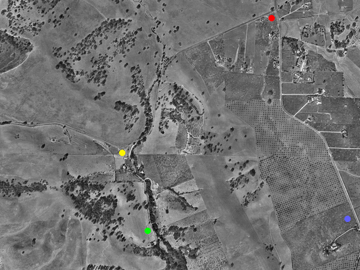
5)  
  • Red Dot (Bottom right of image) is the start of Purissima at the intersection with Robleda
  • Blue Dots (Three of them) following the course of Elena opposite and approximately parallel to Purissima - but on the other side of where Highway 280 runs today.


6)  
  • Blue Dot (Bottom right of image) is Town Hall again, but we can follow Fremont Road all the way up to it origin at
  • Red Dot is where Arastradero passes the intersection with Fremont and continues Southward towards the
  • Yellow dot where Arastradero splits in to two - part of it swings off and continues West past Saddle Mountain (having gone under today's Highway 280), and the other leg turns south to become Purissima Road - where the
  • Green Dot which is roughly where today "the far end" of Elena Road takes off from Purissima and immediately goes under Highway 280 and starts its journey Southward paralleling Purissima on the other side of the Highway.


And that's it for six images of the area around (what is today known as) Los Altos Hills.

One reason these images are interesting is that they give some insight into the original ecology of the region before it begat orchards which begat upscale suburbia.

Clearly these images were taken when the orchards were well established (probably at their peak) but there is still enough undisturbed territory to where we can see the two distinct kinds of landscapes

  • Open grassy hillsides, sometimes sparsely dotted with Oak trees or similar - and sometimes more than just sparsely dotted.
  • Ravines and other watershed drainage courses forming creeks - which are heavily vegetated.
Just look for example near the Green dot in the last image (near the bottom) where we can see the dense growth in the creek running alongside Purissima, and then to the West of the Green dot we see that part of Saddle Mountain that overlooks Highway 280 today (what I call Fenwick's Hill) which has a significant covering of Oak trees - I wouldn't call it dense, but certainly more than just the occasional free-standing tree. And then further South and West over Saddle Mountain - grassy hillside with nary a tree in sight.